
Analysis and opinion · Homes
More of Vancouver should make room like South Cambie
South Cambie has one in nine of the rezoning records we mapped. We think more Vancouver neighbourhoods should make room for apartments and everyday shops.
Share this article
South Cambie accounts for about one in nine of the rezoning application records we mapped. For a small part of Vancouver, that is a striking share of the city's housing ambitions.
The Canada Line is an obvious draw. So is a plan that makes room for more homes around it. We think Vancouver should take that combination seriously, and make apartments and everyday shops possible in many more neighbourhoods.
We went through the City’s rezoning directory and mapped records with application dates from 2020 onward. In our September 15, 2026 snapshot, 49 of the 447 mapped records are in South Cambie.
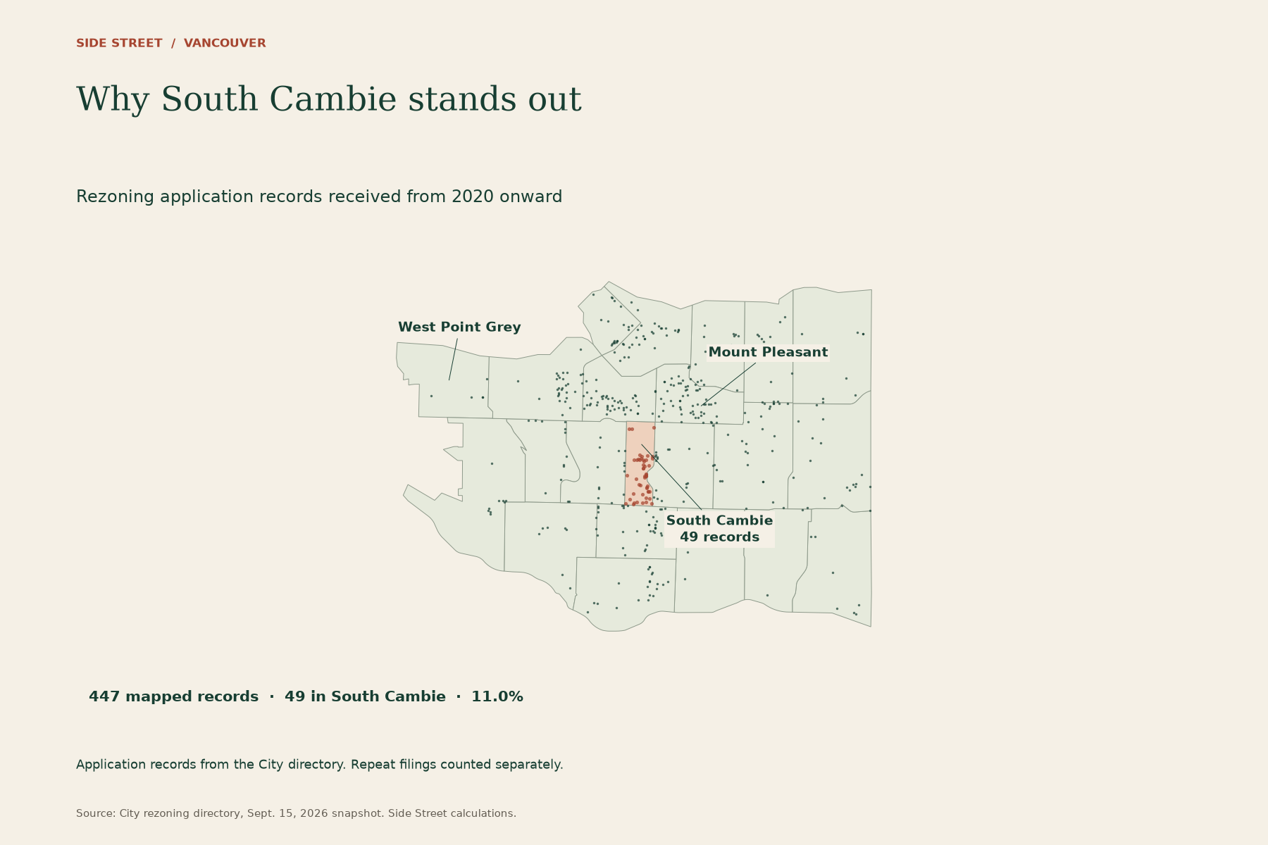
Our interactive map lets you look up a neighbourhood and follow the City’s page for an address.
One large site changes the picture
A proposal for a small rental building gets one dot. So does the former Oakridge Transit Centre, where thousands of homes are proposed. Look at the four South Cambie applications received in 2026 and the scale of that site becomes clear.
Together, they proposed 3,109 homes. The former Oakridge Transit Centre accounted for 2,627 of them, about 84.5%. Add the 202-home proposal on West 28th Avenue and two sites account for about 91% of the total.
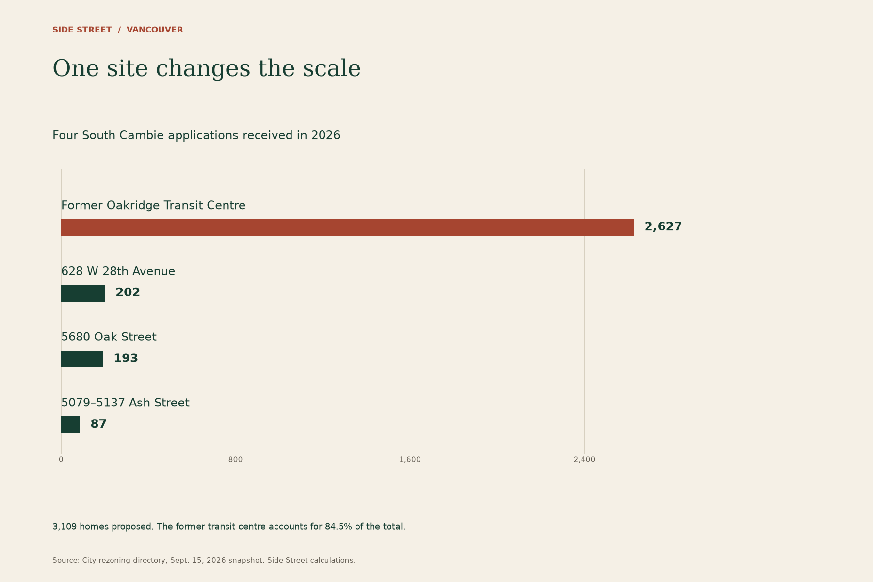
| Application | Homes proposed in the snapshot | Received |
|---|---|---|
| Former Oakridge Transit Centre | 2,627 | June 1, 2026 |
| 628 W 28th Avenue | 202 | May 5, 2026 |
| 5680 Oak Street | 193 | August 5, 2026 |
| 5079–5137 Ash Street | 87 | February 27, 2026 |
| Total | 3,109 |
The three smaller applications would add another 482 homes. Vancouver needs room for those buildings alongside the much larger sites.
The rules put more homes within reach of the Canada Line
South Cambie sits within the area covered by the Cambie Corridor Plan. The 2018 plan anticipated more than 30,000 additional homes across the corridor over the following decades.
Putting more homes near the Canada Line makes sense. It connects this part of the city to downtown and Richmond. Letting more people live close to it is a good use of that investment, and planning rules that allow apartments help make it possible.
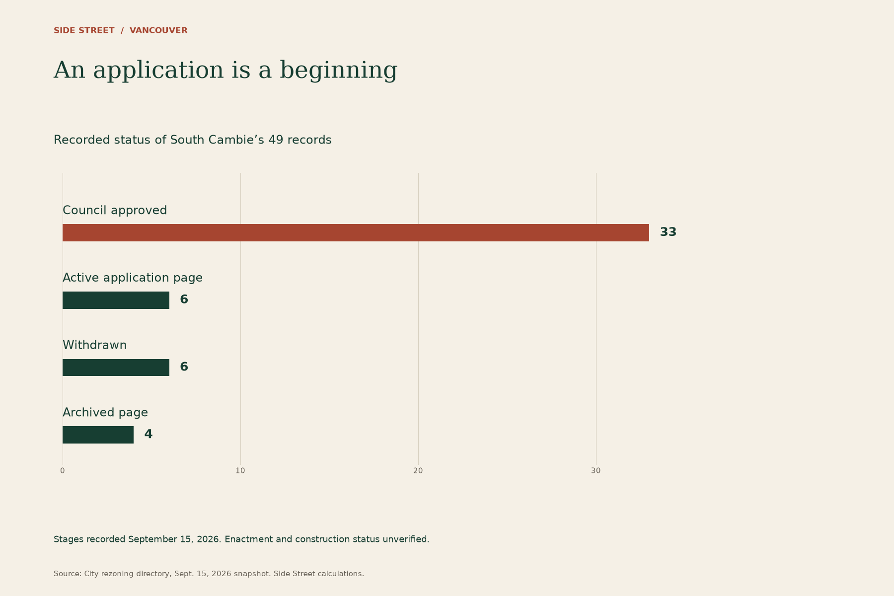
Getting the homes built is the next job. Of the 49 South Cambie records, 33 had reached Council approval in the saved pages. Approval still leaves further steps before anyone moves in.
Vancouver should spread the opportunity
Four- to six-storey buildings with useful shops at street level should have a place beyond a few corridors. We like the prospect of more neighbours being able to walk to a café or pick up groceries close to home. Established neighbourhoods should be able to welcome that kind of change.
Council considered another route in July. The Villages proposal covered 17 of the 25 village centres identified in the Official Development Plan. On July 28 it rejected that proposal and approved single-egress-stair changes and two smaller ODP amendments instead. The City’s Villages page records that decision.
We think Council should return to the broader ambition. South Cambie should have plenty of company on this map. More neighbourhoods should offer room for apartments and everyday shops, with practical relocation help for renters affected by redevelopment.
The Canada Line is a good reason to build here. Vancouver also needs to make room along its other useful transit routes and on more of the streets around them.
Sources and method
This is a dated snapshot of the Shape Your City rezoning directory, saved September 15, 2026. It contains 461 site-application records with received years from 2020 onward; 447 have mapped locations. Fourteen lack locations and are absent from the map. Eleven other directory records have no received year and are excluded from this view. Repeat and revised filings remain separate records. The 49 South Cambie records are all mapped.
The proposed-home comparison reads the four 2026 records in the saved analysis, not current construction totals. It excludes a separate City site identified as having potential for 361 social homes. Council approval is distinct from bylaw enactment. An archived page does not establish a decision. The map’s Broadway and Cambie outlines are simplified context. Proposed Village polygons and comparisons per square kilometre of residential land are omitted because their geometry and denominator were not established reliably. The map describes applications and does not isolate the separate effects of transit, planning rules and market conditions.
The explorer’s assessment layer describes median assessed land and building values for R1-1 and First Shaughnessy parcels, with a 100-parcel minimum. These are neither sale prices nor household incomes. The analysis does not establish that higher-value neighbourhoods generally receive fewer applications. Download the figure data.
Vancouver election guide · Try the Vancouver election compass · Standards and corrections
